Tag Archives: scenic

photo of Inks Lake camp site

Our Inks Lake Getaway

Teardrop Trail Log: August 4, 2017

We met the folks from Southwest Teardrops and Vintage Trailer group at Krause Springs in May of 2016 and attended one of their gatherings at Lake Bob Sandlin last September. I had signed us up for another gathering with the group at Inks Lake State Park beginning August 3. Sadly, we had broken a leaf spring on our trailer on our last trip so we were a day late arriving due to the search for replacements for a broken leaf spring.

photo of Inks Lake State Park Sign

Welcome to Inks Lake!

Inks Lake State Park is considered one of the gems of the Texas Hill Country, near Austin.  About 8,000 years ago, prehistoric peoples lived and worked along the banks of the Colorado River. The Apache and Comanche later ranged through the Hill Country. After Texas became a state, German and other Anglo settlers farmed and raised livestock here. The area was used for cattle ranching since the mid-1800s and it remained a part of various ranches until the state acquired the land. Culverts and roads in the park were constructed by the Civilian Conservation Corps stationed at Longhorn Caverns in the 1930s.

photo of geese entering the lake

Our Neighbors

The 1,201-acre State Park was created from privately owned and Lower Colorado River Authority land in 1940, and is located next to Inks Lake on the Colorado River in Burnet County. Inks Lake is named for Roy B. Inks, one of the original board members of the Lower Colorado River Authority. It is the 2nd lake in the seven Highland Lakes chain. The water level of Inks Lake is usually unaffected by drought and is maintained at a normal level most of the time. The park opened to the public in 1950.

photo of The Gang at Devil's Watering Hole

The Gang at Devil’s Watering Hole

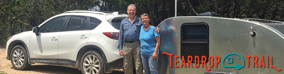
The entrance is off Park Road 4 and after checking in we saw Roger, one of the members of our group. Armed with the park map, we found our campsite on a lovely inlet and proceeded to establish camp. Members of our group were scattered about the campground. Our routine is to walk through the campground visiting with friends and stopping to check out other folks’ rigs, a great way of making new friends.

photo of a potluck supper

SWTVT Potluck

One of the unique aspects of the park is Devil’s Watering Hole, one of the favorite swimming holes in the Texas Hill Country. It is an inlet off of Ink’s Lake, bordered by rock outcroppings. We watched as members of our group paddled, swam and even jumped from the cliff. Later that evening, we joined the traditional pot luck dinner, where everyone tries to outdo each other in quantity and variety of food.

photo of Inks Lake sunset

Another Fine Day

photo of Weston Missouri Main Street

On the Tasty Trail — Lunch at the Tin Kitchen

Teardrop Trail Log: June 20, 2017

The charming town of Weston, Missouri was settled in 1837. The success of the town was based on the exporting of large quantities of tobacco and hemp grown in the region. It was also the town that equipped Lewis and Clark as well as wagon train masters and other adventurers for their trips west. During this time, Weston had grown to be the second-largest river port in the state.

I compiled a list of attractions after Sara Tucker of Cool Tears Magazine had suggested Weston as a stop on the Teardrop Trail. Main Street climbs upward from what had once been the riverbed filled with steamboats. It is lined with quaint, old buildings that exude the charm of a bygone era, many on the National Register of Historic Places. We found a parking spot that would accommodate both the Lady and the Ambassador and began our walking tour of this pre-Civil War town. We passed the Weston Historical Museum, the National Silk Art Museum, Victorian homes, antique shops and more.

photo of The Tin Kitchen interior

The Tin Kitchen

Weston’s rich history includes eating well. We always enjoy new dining adventures when we travel on the Tasty Trail. As we strolled down Main Street, we spotted the Tin Kitchen, Southern Smoke House, that occupies the old Rumpel Hardware building. Built in 1842, the building has been lovingly restored to preserve all of its wonderful charm. We were enchanted by the dining rooms that feature the original pressed-tin ceilings, wainscoting, dark wood tables and bars. We slid into one of the comfy booths that line the walls.

Graphic of Tin Kitchen Logo

Tin Kitchen Logo

I ordered the Friday special, a grilled salmon salad with a yummy Balsamic Vinaigrette and Jim enjoyed The Cheeseburger and 24HR Slaw. After our wonderful lunch, we explored the TK2 – The Public House at Tin Kitchen, offering craft beers on tap along with a full bar featuring a great selection of wine, spirits, and craft-cocktails set in the same lovingly restored interior.

We had developed a fondness for the Show-me state and hope to visit again soon.

On to Edmond, our next stop!

photo of The Cheeseburger and 24HR Slaw

The Cheeseburger and 24HR Slaw

photo of Weston Bend State Park sign

On to Weston Bend State Park

Teardrop Trail Log: June 19, 2017

As we departed Pella, our route took us along Lake Red Rock toward Knoxville, Iowa. The railroads and coal mining had provided growth during the 19th century. My grandmother had been a teacher in a rural one-room school in Marion County near Knoxville. It was so long ago since I had visited her that I only had a few memories from her recollections of her time in rural Iowa.

graphic of Lewis and Clark Expedition Map

Lewis and Clark Expedition Map

Our destination was Weston Bend State Park on the bluffs of the Missouri River. Sarah Tucker, the editor of Cool Tears magazine had recommended the Weston area for its scenic beauty overlooking the Missouri River. The river and the region’s rich soil attracted many Native American tribes including the Iowa, Kansa and Fox. On their expedition to explore the West, Lewis and Clark reached the Weston area in 1804. Their journals detail a Kansa village on the river. Upon their return visit two years later, they described the many fur traders traveling up the river.

The tobacco industry had flourished in the area in the mid-19th century and five tobacco barns are located within the park. The McCormick Distillery that began operations in 1858 east of Weston claims to be the oldest continuously operating distillery in the country.

photo of our camp at Weston Bend

Camp Weston Bend

Weston Bend is little gem of a park, on 1,133 acres with only 37 campsites. We found the campground host and checked in. I have always liked meeting the hosts at each of the campgrounds and have fanaticized about trying the host’s role in the future.

As in many of our camping experiences, we met the neighbors, Steve and Chris Hutoron of Phoenix from the site next door and enjoyed several conversations. As we hiked on one of the many trails, we met other hikers Tony & Maggie with Yadi and Chenielle and their friendly dogs. The highlight of the hike was when we caught a glimpse of the Missouri River at the scenic overlook where Lewis & Clark had seen it.

The next morning, we would set out to explore the historic village of Weston, Missouri.

photo of Historic Missouri River Overlook

Historic Missouri River Overlook

photo of Tour of the Miniature Dutch Village with Doug Heerema

Back in Time – Visiting the Pella Historical Village

Teardrop log: June 19, 2017

Located just across the street from the Royal Amsterdam Hotelon the Molengracht Plaza where we have been staying, is the Pella Historical Village. It offers a look at how early Pella pioneers lived after they left Holland in the 1840’s.

On the grounds, we found the Sod House, a replica of the housing during Pella’s early years. We learned how wooden shoes were made at the Werkplaats. Among the buildings, is the boyhood home of Wyatt Earp, one of the most famous or infamous characters of the Old West, still standing in the historical village.

This slideshow requires JavaScript.

Doug Heerema, our tour guide took us through the enchanting Miniature Dutch Village. It was begun by George Heernan in 1938, as a work study project for students in Pella’s schools and Central College, as part of the Works Progress Administration (WPA). Many of the original structures were created at 1/24 scale and restored in 1978. New buildings have been added. The village is populated with dolls that reflect authentic daily life in a Dutch village. All four seasons are portrayed with a boy flying a kite, flower sellers, farmers gathering hay and ice skaters on frozen canals.

This slideshow requires JavaScript.

Having been in the museum business, I always check out the gift shop when we visit a museum. This one was amazing! One source observed that it had every type of Dutch gift you could want from dishes to wooden shoes. I bought a bag of flour produced at the mill and a Pella cookbook to go with it.

We enjoyed exploring historic Pella. There was not enough time so see everything on the list. We will definitely put this magic place in the list for future trips on the Teardrop Trail!

photo of the Pella Cookbook and Windmill Flour

Pella Cookbook and Windmill Flour

photo of The Vermeer Mill and Historical Village

The Vermeer Mill — A Dutch Windmill Tour

Teardrop Trail Log: June 19, 2017

The star of Pella is the Vermeer Mill — it’s certainly the first thing you notice when you drive into town. Having arrived Saturday evening we were intrigued but could only admire it from the outside. It wasn’t open for tours until Monday morning.

photo In the Historical Village

In the Historic Village

One enters the windmill through the Pella Historical Village gift shop. The tours start at regular intervals for whoever is there. We were shown a short film and presentation by Doug Heerema, one of the mill guides. He then showed us another floor of the museum where an astonishing miniature village is located — but more on this in a later post. Riding an elevator to the fifth floor, we were introduced to Jim Brandl, the “molenaar” or miller for a tour of the Vermeer Mill.

The mill is connected to the museum by a wooden bridge, and on it, you find a panoramic view of Pella. Ahead is an enormous ship’s wheel — used to turn the mill structure to direct it into the wind. It was a clear, fine day with a light breeze, and the miller made a few adjustments. The massive cloth-covered sails began turning as we walked around the platform. Moveable barriers prevent absent-minded tourists from walking into the sails which swing by with impressive speed.

Inside, we found a profusion of massive wooden beams supporting the roof of the mill, which rises two more floors above. Equally massive wooden gears turn a large, wooden shaft which turns the mill stones at about eye level. Grain from a hopper is shaken into the center of the top stone and flour falls from a chute to a waiting bag below. A beautiful modern example of an 1850’s “koren molen” (grain mill) that still works today.

Built by the Verbij Hoogmade BV company in the Netherlands and re-assembled in Pella in 2002, the Vermeer Mill stands on a 40-foot-high brick base to reach a height of 124 feet at the tip of the tallest sail. Made of 16 different wood species from 6 countries, the mill supports two, five-foot in diameter, 3500-pound mill stones. 500 pounds of flour can be ground in one hour with a brisk wind. With woods like Purpleheart, Ironwood, Acidwood, Oak, Scots Elm, Teak, Lignumvitae and the exquisite joinery needed to build with them, this is a feast for anyone interested in fine woodworking.

The third floor is a small museum showing Dutch mill technology. Scale models show the mill’s inner workings, while a series of framed prints show the many variations of mill developed for specialized uses.

This slideshow requires JavaScript.

The second floor is a recreation of the molenaar’s living arrangements. Compact but comfortable, it is the ultimate in thrift and short commute. This way, he was always nearby in case of bad weather to turn the mill cap into the wind. The “bed stede” or bed is interesting. The doors could be closed for warmth, but it was shorter than we’re used to, as people in the 1850’s believed it was unhealthy to sleep lying flat.

photo of The Molenaar's Home

The Molenaar’s Home

photo of Wind Power in Rural Iowa

On to Des Moines: Windpower in Adair

Teardrop Trail Log: June 14, 2017

I’ve been across Iowa many times. My friend Bob and I used to promote the Surplus Sales business at area Hamfests, and there were big annual gatherings in Cedar Rapids and Chicago. It has been 20 years or more since then and things have changed. Wind farms. Since Iowa produces corn, which was once called the fuel of the future when used to make gasohol, I assumed it was the main renewable energy industry in Iowa. Poor assumption. What a great surprise!

A little research around the Web told the story. Although Texas has the largest capacity of wind power generation in the nation (20,321 megawatts at the start of 2017), Iowa is second with a capacity of 6917 megawatts. The real surprise, it leads the nation in percentage of generation by wind — supplying over 36 % of the state’s power needs (as of 2016).

There are several reasons for this. First, Iowa is located in the wide swath of land reaching from South Texas up through North Dakota blessed with ample, year round wind. This includes other states located east of the Rocky Mountains and west of the Mississippi River. These states enjoy 50 to 100% more wind than most other states with Iowa coming in as the seventh-windiest.

Second, the Renewable Electricity Portfolio Standard, signed into law by then-governer Terry Branstad in 1983.  It required utilities to purchase electricity from renewable sources at a fixed price. The state was in a farm crisis, and this was seen as a way to provide extra income to farmers who really needed it. The law was the first of its kind in the nation and was the first guaranteed market for wind energy.

On top of that, Iowa has available land, and practical farmers who saw wind “farming” as just another crop. The icing on the cake? The state attracted companies that manufacture turbine components.

When we arrived at the Iowa State Fair later that day, the first thing I noticed was the giant wind turbine on the hill next to the campsites. I never fail to learn new and inspiring things about our country as we travel in our teardrop trailer.

photo of Wind Turbine at the Iowa State Fair

Wind Turbine at the Iowa State Fair

photo of Jim Experiencing Scenic Point near Jasper, Arkansas

The Ambassador in the Ozarks

photo of the Mimosa trees that are common along the road

Mimosa trees are common along the road

After having lunch at the Baker Creek Heirloom Seed Company, it was time to beat feet. It looked like a 4-hour trip to Little Rock, but we didn’t know the roads and couldn’t go quite as fast as travel estimates since we were pulling the Ambassador. It looked pretty doable though, and Marilyn is a master navigator. As she considered various routes, I enjoyed the scenery.

As we crossed the border into Arkansas, Marilyn settled on Highway 7 — a route that would take us through the Ozarks. Based on the National Geographic Road Atlas, it looked like the most direct path and seemed to be on a substantial road. It was very scenic, but the road was winding, narrow and hilly. I was hoping the travel estimates accounted for diminished road speed and began to think we might be a little late into Little Rock. This is part of traveling through new territory. You can’t always predict what you’ll find, and you just have accept it.

photo of The Tower

The Tower

The forest and road seemed to go on forever. We had passed through Harrison some time ago and the road was still narrow and hilly. The dense Ozark forest was interesting though.  Then, we began ascending and had to slow down. After passing through Jasper, we continued up the mountain. In a little while, we broke into a clearing and were on top of the world. Stopping at the Scenic Point Gift Shop, we got out to look around. The views were spectacular, and best of all, there was an old wooden tower to climb. From the top, you could see the Buffalo River basin. Missouri is visible to the north, with views that encompass about 1.3 million acres in all directions. Far from an unwanted delay in our trip, this had turned serendipitous, with the discovery of a place we would have to revisit and explore. Salute!


photo of Buffalo River Canyon

Buffalo River Canyon

photo of building that is All dolled up

Antiques in Perry

Map of the Mark Twain Lake area

Mark Twain Lake area

Teardrop Trail Log: June 15, 2016

We’re rarely on the road early, and by the time we visited the Mark Twain Birthplace and navigated across Mark Twain Lake it was nearly noon. Just as the thought of lunch was occurring to me, we pulled into Perry, Missouri. Once a booming coal town, it is now a destination for lake fun and antique shopping. It is also one of the prettiest small towns in Missouri.

After lunch at the Hootenanny, I wanted to walk around and photograph some of the buildings. Within a block of Palmyra and Main, there are several ornate examples of late-nineteenth century commercial architecture including wood, brick and cast iron façades.

photo of Miss Daisy's Antiques

Miss Daisy’s Antiques

Many of the buildings now house antique stores. We took the time to explore one particularly promising one. I’m a woodworker and enjoy finding, restoring and using old hand tools. This store had a generous supply of old saws, planes, chisels and the like and I couldn’t resist exploring. There were lots of other things to look at, and we spent about an hour there. We were definitely going to have to visit again when we had more time. Sadly, we needed reach Peoria by late afternoon and play time in Missouri was over for now!


photo of interior of River Reader Books

On to Lexington

Teardrop Trail Log: June 14, 2016

photo of stuffed bear in Pat's Army Store

Pat’s Army Store Inmate

I was introduced to historic Lexington, Missouri when I was in the neighborhood for a presentation in June on my cookbook – Canning, Pickling and Freezing, with Irma Harding. The meeting of the Missouri Cattlewomen was held at the historic Elms Resort and Spa in Excelsior Springs. I researched the Resort built in 1898, and discovered it was “haunted.” I had previous experience with haunted hotels when I worked in Santa Fe so I felt right at home. Actually, the hotel had several interesting guests including Al Capone and Harry S. Truman. It was an amazing experience. My talk, “Eat, Drink, and Pickle!” was at VanTill’s Family Farm & Vineyard. I fell in love with the area and the people.

Photo of River Reader Façade

River Reader

As we left Kansas City, I was looking at the atlas and Lexington was only about 50 miles away. We were so close, I suggested we take a side trip so Jim could meet my friends and see Lexington where there is lot’s of history from the Civil War. After parking the Lady and the Ambassador, we stopped in at Pat’s Army Store, located in an old Baptist Church. Next, we stopped by the Old Trails Region to see Marsha Corbin, my host. I met Marsha at last year’s Red Power Round Up where she’d heard my presentation. She was just down the street for a meeting, so we proceeded to say hello. Next stop was one of the most amazing independent bookstores, River Reader owned by Pat and Gary Worth. I had a great book signing at River Reader. Pat offered a couple of bottles of cold water on the warm day and It was nice to connect everyone with Jim.

We left River Reader and Jim was taken by the scenic beauty of the town. The Greek Revival Lafayette County Courthouse built in 1847 and other historic buildings led the town to bill itself as the “Athens on the Missouri” and became subjects for his photography.

photo of Marilyn and Jim in front of a teardrop trailer

The Adventure Begins …

Teardrop Trail Log: June 12, 2016. Red Power Roundup trip start.

Building, modifying, cleaning, planning and packing complete, the day of departure finally arrived. If we didn’t have it, we didn’t need it. We left midday, intending to reach Lake Bob Sandlin State Park in northeast Texas by early evening. Marilyn had a route, and it looked like a great day for travel.

All went well for the first hour or two and we joined I-35 at Round Rock. It was Sunday and I commented on how well traffic was moving. I must have jinxed it, because we encountered the first construction shortly after around Salado, and it continued all the way to Waco. What should have been an hour took more that two. Not a great start.

photo of American Lotus (Nelumbo lutea)

American Lotus (Nelumbo lutea)

To avoid further construction, we turned onto Highway 31 towards Corsicana, reasoning we would see the back country, and go through a few quaint, small towns. The scenery was beautiful, and we encountered a vast expanse of American Water Lilies in Henderson County between Trinidad and Malakoff. We pulled into the roadside park to make photos. The sky was threatening however, with consequences later in the day.

photo of threatening sky

The sky threatened …

Turning north on Highway 19 at Athens, Texas, we were still making good time. Marilyn wanted to head northeast, more directly toward the state park. At Canton, we turned onto FM 17 (a two-lane “farm to market” road). More great scenery. Lush fields of hay with stands of tall pine trees dotted the landscape, set off by a dramatic sky. Although not Interstate speeds, we were sailing along when …

photo of car fire near Fruitvale, Texas

A fiery road-block near Fruitvale, Texas

We encountered a blazing car fire with traffic stopped in both directions. Sitting in the long line of cars for about 10 minutes, it was clear that it might be hours before the road opened. We had to go back. Now I had to turn our rig around on a narrow, two-lane road with no shoulders and no place to pull out — all with an audience of the several dozen.

Perfect.

Marshaling my best backing skills, I completed the U-turn in a few minutes. Thank goodness our rig is small. Anything larger and we would have been stuck. Retracing our steps back to Canton, we took I-20 West and re-joined Highway 19.

By now the light was fading, and we would have to set up in the dark. We’ve done it before, and it’s not so bad. Then it started to rain. Hard. Driving toward Sulphur Springs, the downpour worsened, with poor visibility as well. Perhaps a nice motel room would be best.

Reaching Sulphur Springs and I-30, we headed east toward Mount Pleasant. Marilyn called ahead and made a reservation. Arriving around 10, we loaded into the room in the pouring rain. Although low cost, a warm, dry room seems like a palace when compared with setting up in a dark, rainy campsite. Roughing it in a Motel 6 is still camping, right?

photo of car and trailer in the rain

Mt. Pleasant Motel